Posts filed under ‘Second Grade: India Unit’
Signs Along the Way
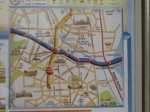
Delhi Metro Map
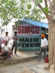
Delhi barber shop

This "heating elements" was an odd site in Old Delhi as temps were well into the 100s
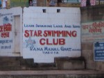
Along the Ganga ghats in Varanasi
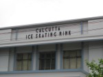
I guess this was built decades ago and is no longer in use. Too bad hockey fans.

Good advice from the Delhi Metro
Agra the Great
August 1, 2009
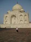
Taj Mahal
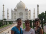
Fellow Fulbright-Hays teachers Carrie Block and Katie Clary at the Taj Mahal
Agra the Great would be an appropriate way to describe all of the monumental structures that spill out of this one-time Mughal capital. Agra is home to the Taj Mahal, Fatehpur Sikri, Itmad-ud-Daula’s Tomb, and Agra Fort to name the main highlights. It is fascinating to realize that all of these structures were built in the 16th and 17th centuries-the same time period as the Europeans were exploring the Americas and establishing permanent settlements.
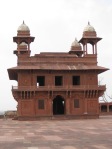
Akbar's hall for public audiences at Fatehpur Sikri: the "City of Victory"
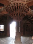
Akbar's seat above the public hall floor
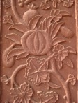
Close-up of carved plant at Fatehpur Sikri
Akbar the Great (Akbar means great so in English he would be Great the Great-he ruled from 1556-1605)) constructed Fatehpur Sikri on the outskirts of Agra and it was the capital of the Mughal empire for 14 years. Like all of Akbar’s buildings, it is made of red sandstone with detailed relief carvings and inlays of plants, flowers, and geometric designs. Like many royal cities, this site has one building designed specifically for public audiences. The king’s throne is on top of a pillar in the middle of a room with walkways running from it to the four corners of the building. Akbar’s subjects stood below the pedestal to ask for his intervention in various matters. The whole complex reminded me of Beijing’s Forbidden City with its many courtyards, pavilions, and spacious living quarters.
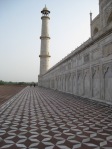
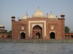
Northwest Mosque at the Taj Mahal
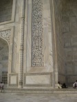
Verses from the Koran inscribed on the Taj Mahal
I feel somewhat guilty not having a blog entry just for the Taj Mahal, but the whole city is just so impressive it is difficult to leave anything out. We arrived at the Taj Mahal in the early morning so as to see it at sunrise. It is truly an amazing mausoleum and is flanked by two red sandstone buildings; the Northwest mosque sits on one side and its mirror image on the other of the Taj Mahal. This building was called the guesthouse by the British but it was never used for this purpose during Mughal reign. It was built just to provide symmetry for the mosque. The Taj Mahal, built by Shah Jahan (r. 1627-58) is a really a stunning complex and I was honestly moved to tears when I first saw it through the entry gate. I have taught my second grade Taj Mahal lesson so many times in the past two years and I was always unable to answer so many of the students’ questions, I am excited to share my experiences during this coming school year.
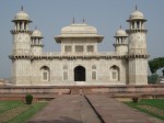
Itmad-ud-Daula's Tomb
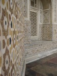
Outside wall of the tomb inlaid with various stones
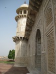
Tomb wall
After a few hours at the Taj Mahal, we went to Itmad-ud-Daula’s tomb. I was a bit skeptical about our guide’s claims that this building is, in many ways, more captivating than the Taj.
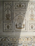
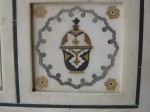
Stone inlay, small yet elegant
Stone inlay close-up
The tomb built by Nurjahan, the wife of Emperor Jahangir, in 1628 seems to have been Shah Jahan’s inspiration for the Taj. Nurjahan built this tomb for her parents but there are also many other family tombs within the mausoleum. The detailed inlay work in this structure is truly breathtaking and in this area it beats the Taj Mahal hands down.
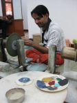
Inlay craftsman
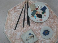
Tools of the trade
After touring these stunning sites, we went to a marble factory where men from the same families as those 16th and 17th century skilled craftspeople created works of art using similar methods, tools, and materials. Their work is now for sale in the forms of everything from tabletops to coasters.
We are off to Jaipur tonight and I am looking forward to another 2nd class AC train ride!
Snapshots of Varanasi
-
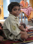
Six year old boy at Asha Deep school
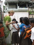
- Connie Rao, principal of the Asha Deep Vidyashram. This school serves poor children. Ms. Rao, an American, has developed wonderful connections with the students.
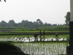
Rice farming outside of the city
Videos on Teacher Tube
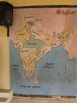
Map at a government school in Chennai
http://teachertube.com/viewProfile.php?user=Hundleyjane&ref=Hundleyjane
Check out the videos from time to time to get a better view of India!
Teaching about India to Second Graders: A Dynamic Process!
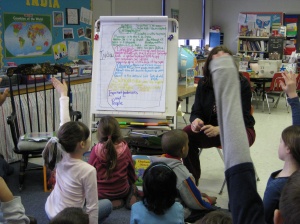 The India unit is a perfect example of collaboration between the curriculum department, classroom teachers, and consultants. The implementation is based on long-term professional development through model lessons and workshops. The unit is dynamic and incorporates literature, geography, technology, and inquiry-based learning.
I started developing the standards based India unit in 2007-2008 with help from teachers and Vanita Shah at the Teach India Project. I taught the series of five lessons to the majority of students in spring 2008 and I have continued to work with the remaining classrooms in 2009. The goal is for teachers to use my model lessons to teach the unit in the coming years.
The students have gained a great deal from the hands-on activities and technology integrated lessons. The lessons ranged from geography to the Taj Mahal to Ghandi. But at the end of the series, I have struggled with an effective summarization activity. I have tried a few different writing prompts but they did not capture what students really learned and could express in verbal conversations.
To meet this need, I took the Thinking Maps workshop presented by Karen Sunderland. (Karen was trained in the Thinking Maps during a summer professional development course). During this Saturday session, Karen led groups of teachers through the eight maps and lively discussions flowed throughout the day about the many classroom uses of the maps.
From this workshop, I decided to use the “brace map” to help students summarize their India learning. The “brace map” allows students to list and analyze the parts of the whole. The whole in this case is India with the parts falling into five categories: Geography, Language, Schools, Animals, and Important People/Places.
One key feature of Thinking Maps is the use of color; each category is color-coded to increase student comprehension and retention. In order to summarize the India unit, small groups of students were given a category, a color, and matching sticky notes on which to record their answers. The class then posted and discussed each group’s responses. During this process, it became clear that a few of the groups had recorded incorrect information. These responses became fantastic teachable moments and helped to clarify some misconceptions.
After the sticky note phase, we recorded the information on the large (although it could have been much larger!) brace map. The photos and video are from this final phase in the process. On the perimeter of the brace map is the “frame or reference”. This is the area on a Thinking Map were students record their sources of knowledge.